|
|
Facts & Figures |
|
|
|
||
|
|
||
|
|
Population:..................................46,593 (as of Year 2000) Geographical coordinates............ in degrees minutes seconds (Latitude : 12 00' 10'' Longitude : 123 58' 47'') in decimal degrees (Latitude : 12.003 Longitude : 123.980)
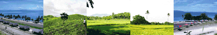
View of Cataingan........................click here to see the satellite view of Cataingan Households:..................................9,310 (as of Year 2000) Registered Voter:.........................26,273 (as of June 2005 - Nat'l. Statistical Coordination Board) Principal Dialect:........................ Bicolano, Waray, Cebuano and Hiligaynon No. of Barangays:........................36 No. of Schools:............................45 Topography:............................... The topography of Cataingan is generally rugged, with several fertile plains between the elevation. Although Cataingan is basically a coastal municipality, its bigger portion situated in the hinterlands of Masbate. Including the Poblacion, it is composed of 36 barangays, eight (8) of which are found along the national highway, nine (9) are along the seashore and the rest are in the interior. The general characteristics of the terrain are from gently rolling and sloping to hilly and mountainous. The municipality’s highest elevation is at 300 meters above mean sea level (AMSL) at the northern part which is mountainous; the lowest is located at the coastal portion of the Poblacion and of the other seashore barangay at about 2 meters AMSL. Although the central part is hilly, it is traversed by several rivers which serve as its natural drainage. The general direction of the elevation is from the coast and southwestern portion which are level to nearly level converging at the middle where Mt. Bagacay and Mt. Tuybo soar to an elevation of about 300 meters.
Principal products/crops:.............Corn, coconut, rice and banana Industries: ...................................Cattle raising (major industry), fishing, agriculture, and mining Mineral Resources:..................... Gold, manganese, limestone, silver, iron, chromite, lead, zinc, and coal. Forest Resources: .......................Timber Tourist Attractions: ..................... 1. San Pedro Beach Resort 2. Kalasangan Hills 3. Centennial Cross Town Patron Saint: ....................St. Vincent Ferrer Town Fiesta................................ April 25 - Every year
NATURAL RESOURCES: Land Area:.................................224.21 square kilometers Land Use:...................................121 square kilometers - Cultivated Croplands 1.45 square kilometers - Irrigated Land 1.00 square kilometers - Fishponds
RENEWABLE ENERGY RESOURCES: Solar Energy Land Use:.............. 5 kwh/m2/day Wind Speed................................200-400 w/m2, 5.6-7.0 m/s Hydro Power...............................50 Watts
OTHER LIVELIHOOD ACTIVITIES:
|
|
|
|
||
